 Nature in Greece | Mountains, lakes, forests, fauna and flora
Hiking in Tymphe (Tymfi) Mt., Greece

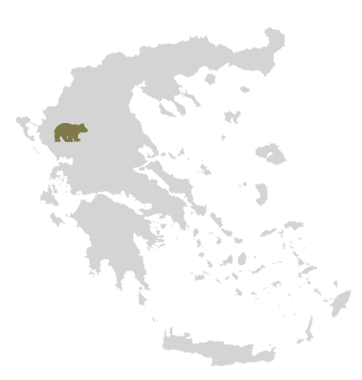
One of the most popular hiking destinations of Greece is Mt. Tymphe (Tymfi) which is located in the region of Zagori, in the National Park of Vikos-Aoos in Epirus. Its slopes are covered by cedar, beech and oak forests at lower altitudes and pines and firs at higher. Rare mammals, among them otters, wolves and brown bears, birds, such as the golden eagle and the shore lark, find shelter in the region, while rare amphibians like the triton inhabit the high-altitude alpine lakes, such as Drakolimni at about 2,000m.

… 3 hours to Astraka refuge
The massif of Tymphe (Tymfi) – part of the northern Pindus range – encloses Vikos Gorge, home to the springs of Voidomatis river, which flows to the mountain’s southwest until it meets Aoos river, which separates Tymphe (Tymfi) from nearby mount Trapezitsa.
Tymphe (Tymfi) is suitable for hiking all year long. Several trails cross the mountain, while adventure-seekers will not be disappointed by the great number of cliffs and steep edges. An exploration of the entire mountain will take you several days. Deep vertical caves may be observed behind Astraka peak and on the mountain’s southern slopes. Best known among them are the Hole of Odysseus and Chasm of Epos (451 meters deep), both named after mythology.
About Tymphe (Tymfi):
Highest elevation: Gamila 2,497m
Distances from:
Athens 495 km
Thessaloniki 314 km
Astraka Mountain Shelter on Tymphe (Tymfi):

Astraka mountain shelter on Tymphe
Altitude: at 1,930m
Capacity:
50 people from May – October
35 people from October – May
Distances from:
1. Papigo 2-3 hrs
2. Konitsa 5-6 hrs
3.Bryssochori 8-10 hrs
4. Tsepelovo 6-7 hrs
5. Bradeto 5-6 hrs
Contact info:
T. +30 697 32 23 100
info@astrakarefuge.com | www.asrakarefuge.com
A beautiful hiking trail
A beautiful path to follow, part of which belongs to the Greek National Trail O3, is that beginning from Mikro Papigo, passing by Astraka mountain shelter and arriving at Drakolimni. The trail starts at Mikro Papigo village, near the village entrance, and its first part is paved.
After passing the shelter, you continue towards Xerolimni and Tsoumani sheep fold; then straight ahead, crossing the stream. On your right is Ploskos peak, with its impressive rock formations.
Once at the lake, you should be able to see Gamila peak on your right and Trapezitsa straight ahead; the mountains visible in the distance are Smolikas and Vasilitsa.
What else is there to see in the area?
 nearby Mikro Papigo in the Zagori region, Greece")
“Ovires”, small natural pools
Tymphe (Tymfi) is surrounded by beautiful traditional stone villages, which are part of the Zagorochoria region. Papigo, Aristi, Monodendri, Pedina, Bitsa, Dikorfo, Tsepelovo, Kapesovo, Bradeto to name some. The area is “decorated” with many stone arch bridges some of which date back many centuries. The most famous bridges being those of Konitsa, Kokkoris or Noutsos, Kapetan Arkoudas, Kontodimos or Lazaridis, Klidonia or Voidomatis, Misios, Tsipiani and Milos.
Vikos gorge, with its dense forests and the springs of Voidomatis river, is a very popular hiking destination. Lazaridis Botanical Museum in Kipoi village houses images and specimens from rare plants and herbs growing in the gorge. On a hot day, you may attempt a dive into the small natural pools ( Ovires ) created along the river, near Mikro Papigo.
Skiing in the area
Tymphe (Tymfi) is suitable for backcountry skiing but for the aficionado there are two skiing resorts, Basilitsa in Grevena and Metsovo in Ioannina, each at about two hours distance.